Watermark your photos from the field with different location-based text strings from one easy to use app.
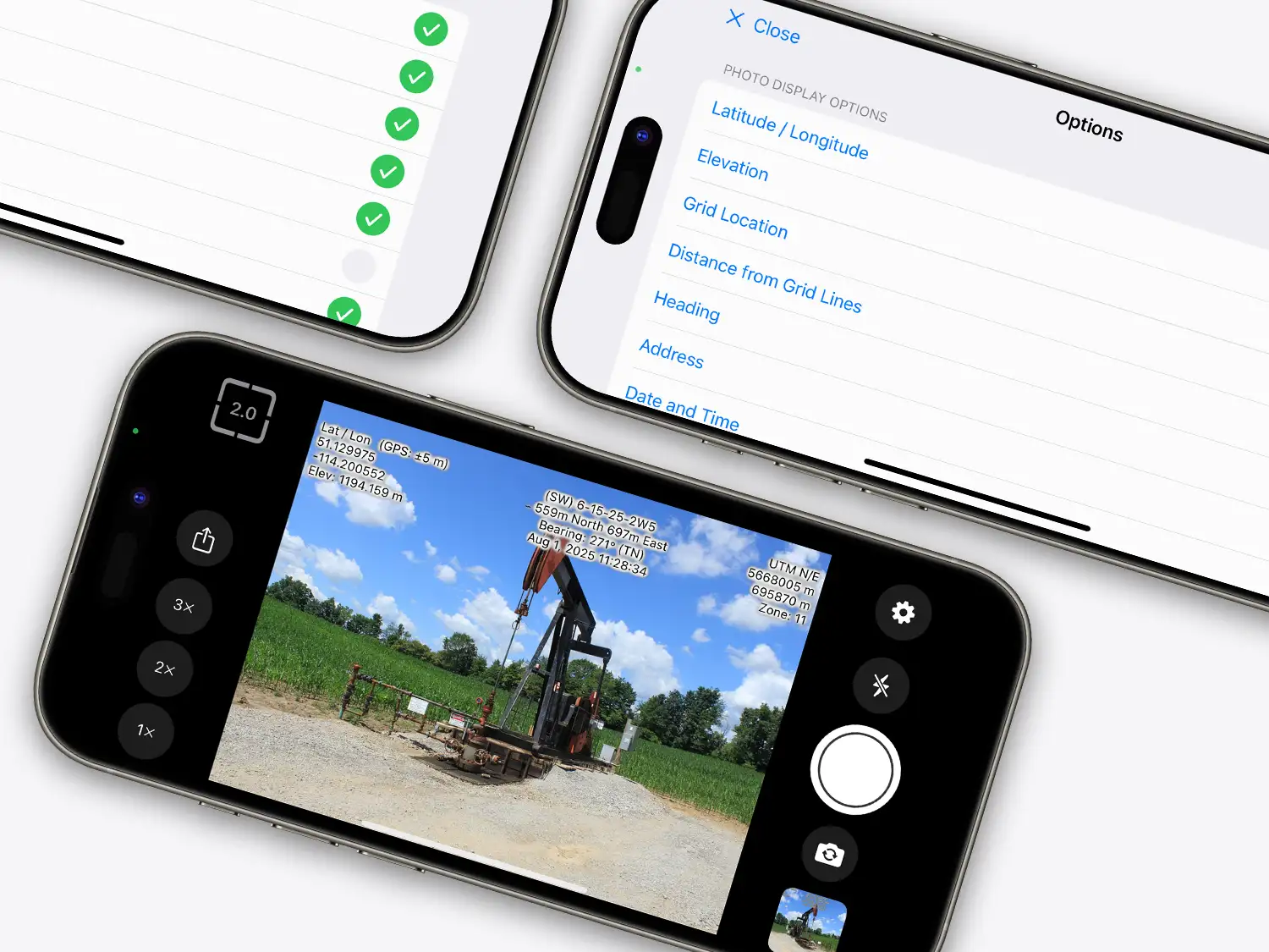
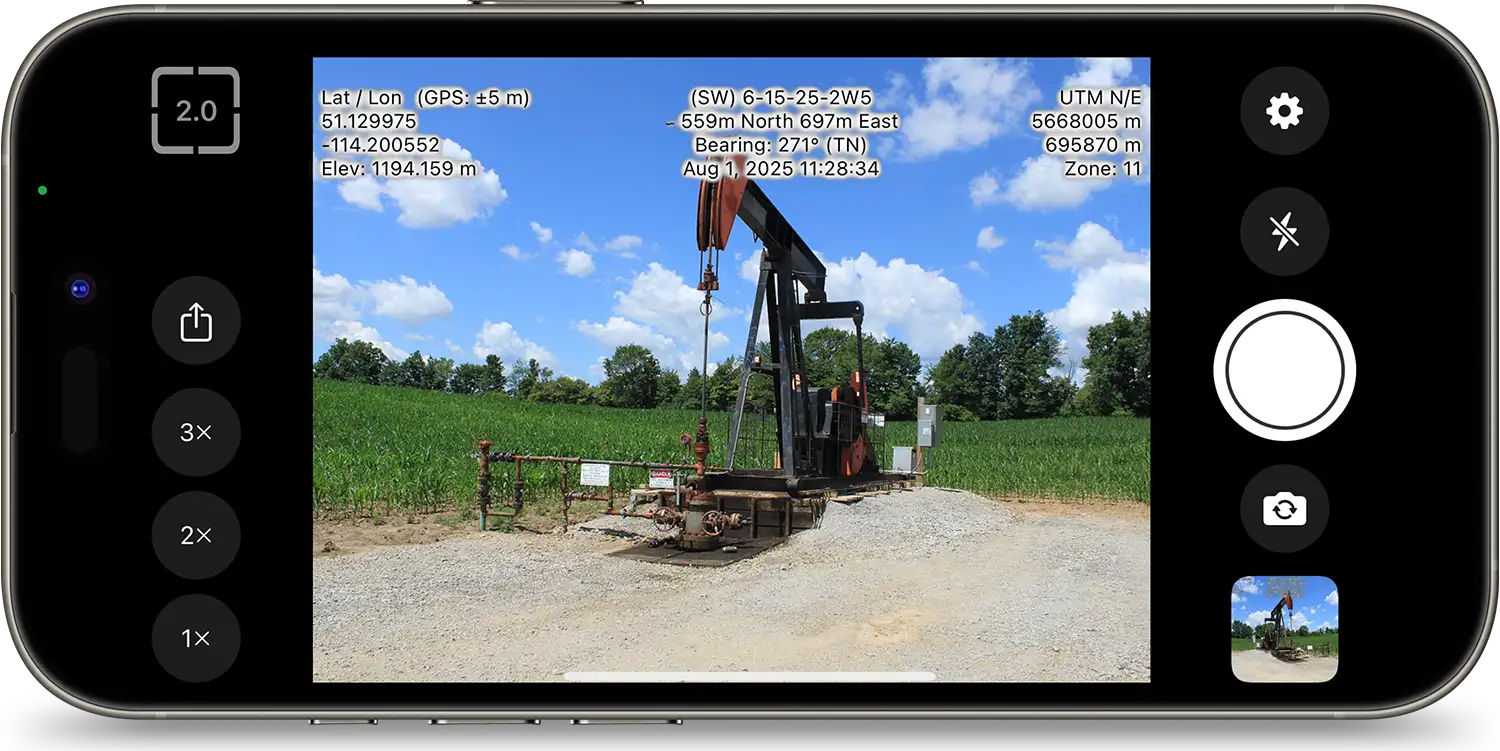
Capture photos and add watermarks of various location-specific details, including Latitude/Longitude, LSD/NTS Grid Location, UTM Coordinates, Bearing, Elevation, Street Address, Date/Time, and more, on images.
An offline fast-mapping engine of Western Canada with an intuitive interface & GPS tracking.
ExploreThe most robust, accurate & comprehensive pipeline and well data in Alberta.
ExploreAccess digital survey plans for the activity taking place on Crown Land for the Government of Alberta.
Access BADGRWestern Canada’s leading mapping & visualization software solution displaying complete land & infrastructure information.
ExploreTransform outdated inspection cycles and reduce risk by streamlining management of pigging, cathodic data, and more.
ExploreManage your assets with features like file storage, inspection service and scheduling, tasks, and more.
Explore