AbaData’s Data and Shape Files are available for all current and historical pipelines and wells in Alberta. Data is updated monthly, so you know you have the most accurate and current data available.
Get startedAbaData's data and shape files are available to access and use in multiple ways.

An offline fast-mapping engine of Western Canada with an intuitive interface & GPS tracking.
ExploreThe most robust, accurate & comprehensive pipeline and well data in Alberta.
Get startedAccess digital survey plans for the activity taking place on Crown Land for the Government of Alberta.
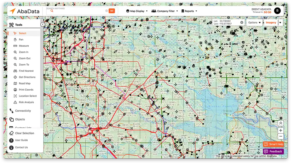
Access BADGRWestern Canada’s leading mapping & visualization software solution displaying complete land & infrastructure information.
ExploreTransform outdated inspection cycles and reduce risk by streamlining management of pigging, cathodic data, and more.
ExploreManage your assets with features like file storage, inspection service and scheduling, tasks, and more.
Explore